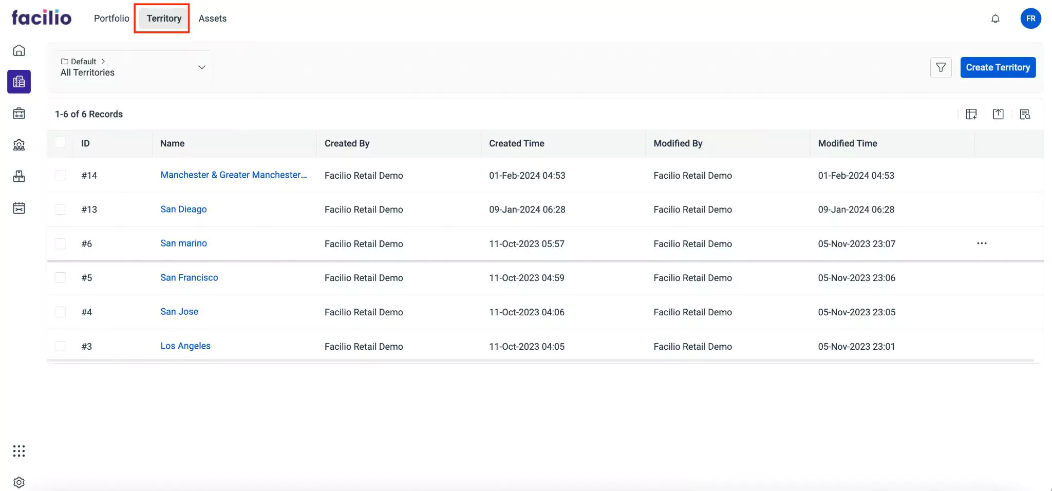
Creating a Territory
A territory is a defined geographical area or region that is assigned to field service resources such as technicians for service delivery. Territories are created to efficiently organize and manage field operations, ensuring that resources are allocated accurately to meet customer needs within specific geographic areas. By organizing territories based on certain aspects like geographic location, customer density, and service demand, facilities can ensure that resources are distributed in a way that minimizes travel time and maximizes productivity. To create a new territory,
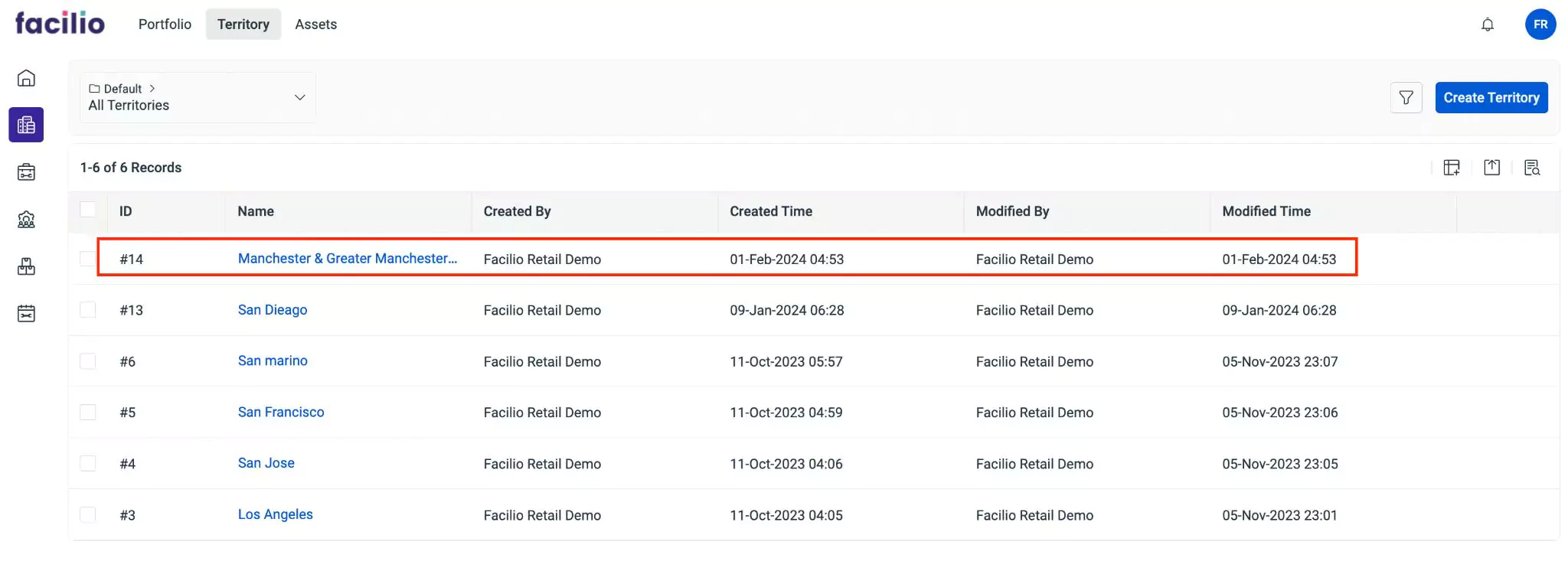
Navigate to Territory. The available list of territories appear as shown below.
Click Create Territory at the top right. The Territory form appears as shown below.
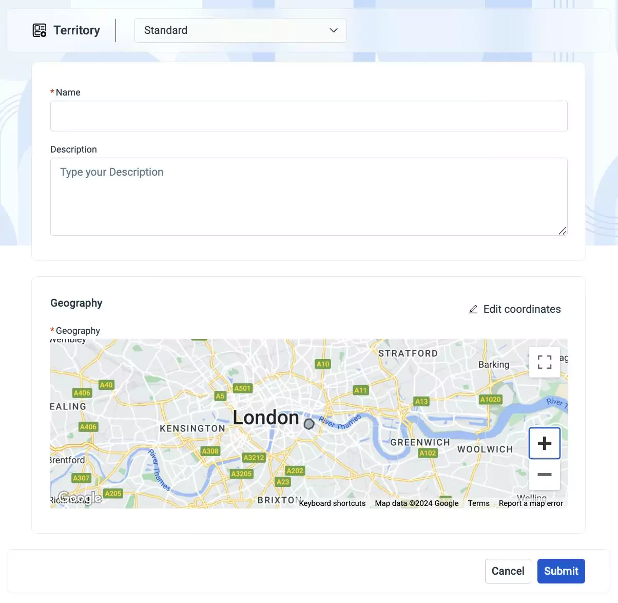
Update the required fields in this form.
Name - A label to identify the territory
Description - A short note describing the territory
Geography - The geographical information of a region covered by a specific territory. To configure location parameters, click the
 option on the top right. The Geography window appears as shown below.
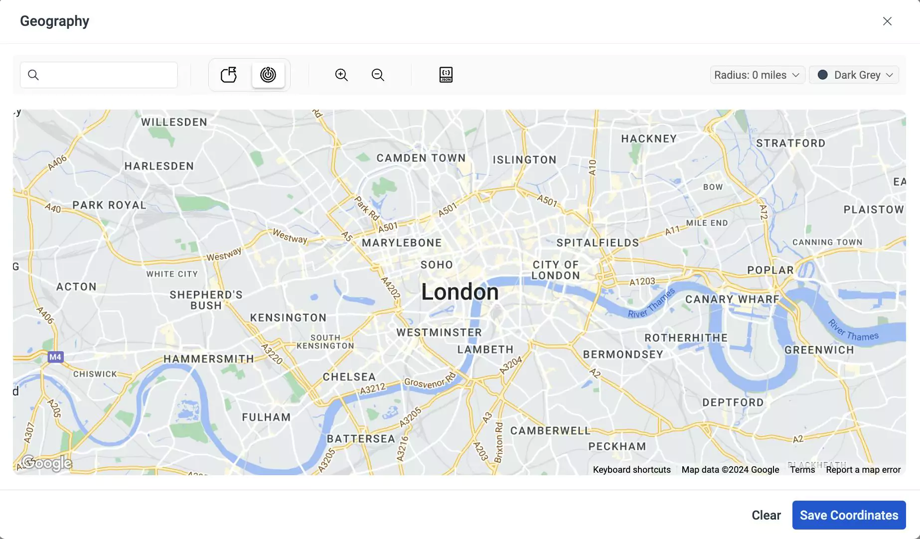
This window allows you to search the location from the Search bar and specify the physical boundaries for that location. You can shape the geographical structures by any one of the following options.
Icon Action/Description 
This icon allows you to manually create boundaries on a map in polygons or like any other shape. You can click and drag the points to outline specific areas and define the territory 
This icon allows you to create territories in a circular area. You can select a point to be centered on the map and define the radius from the central point. You can set radius using the Radius field on the top right 
This icon allows you to enter the GeoJSON code which is a standardized format for encoding geographic data structures such as points, lines, polygons, and multi-polygons to accurately visualize territories on maps You can zoom in/zoom out the map using the
 and
and  icons respectively.
You can select the preferred color for highlighting the geographical region using the
 option from the top right of the window. Once done, click Save Coordinates. A geography location is added in Geography as shown below.
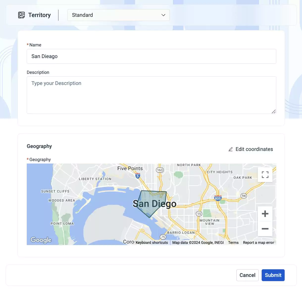
You can use the Edit Coordinates button to modify details of the geographical region.
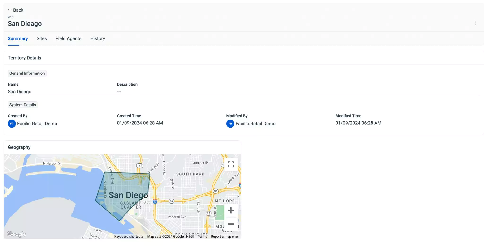
Click Submit. The details page of the territory appears as shown below.
The created territory is added to the list of the All Territories screen as shown below.